Flood Mitigation
Flood management along the Elbow River is part of a coordinated regional strategy shaped in response to the 2013 Alberta Floods.
Since then, both the City of Calgary and the Government of Alberta have implemented a series of measures to reduce risk and improve long-term resilience, combining upstream infrastructure with updated planning and mapping.
Upstream Flood Protection
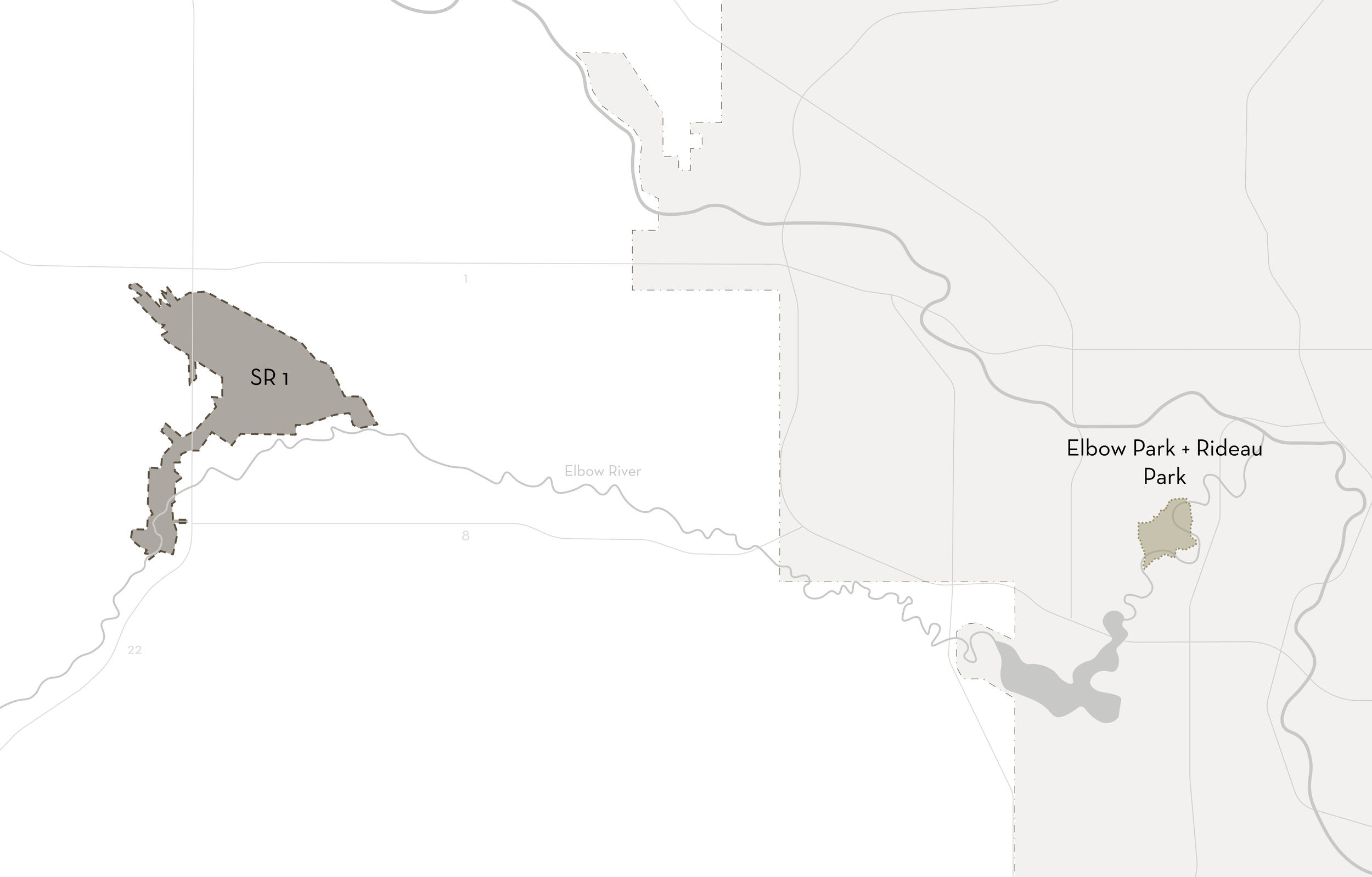
The Springbank Off-Stream Reservoir, known as SR1, is a major regional project by the Government of Alberta, designed to reduce peak river levels during extreme events. Located in Springbank, it temporarily diverts and stores excess water from the Elbow River, releasing it gradually once flows subside.
Calgary impact:
Reduced peak water levels through inner-city neighbourhoods along the Elbow River, including Elbow Park and Rideau Park
Decreased likelihood of overbank flooding
A system-wide approach to flood mitigation
For more information, visit:
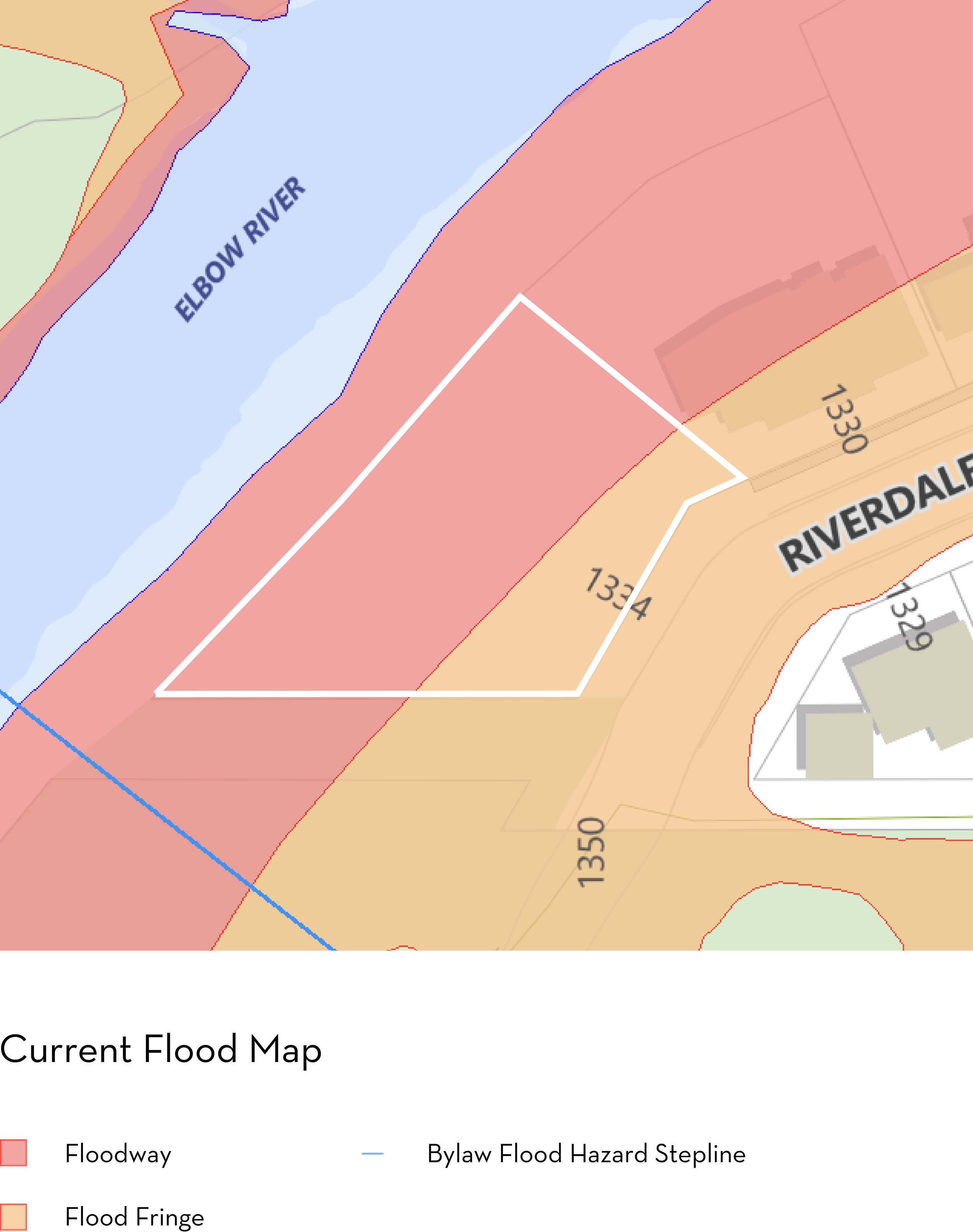
Updated Floodplain Mapping
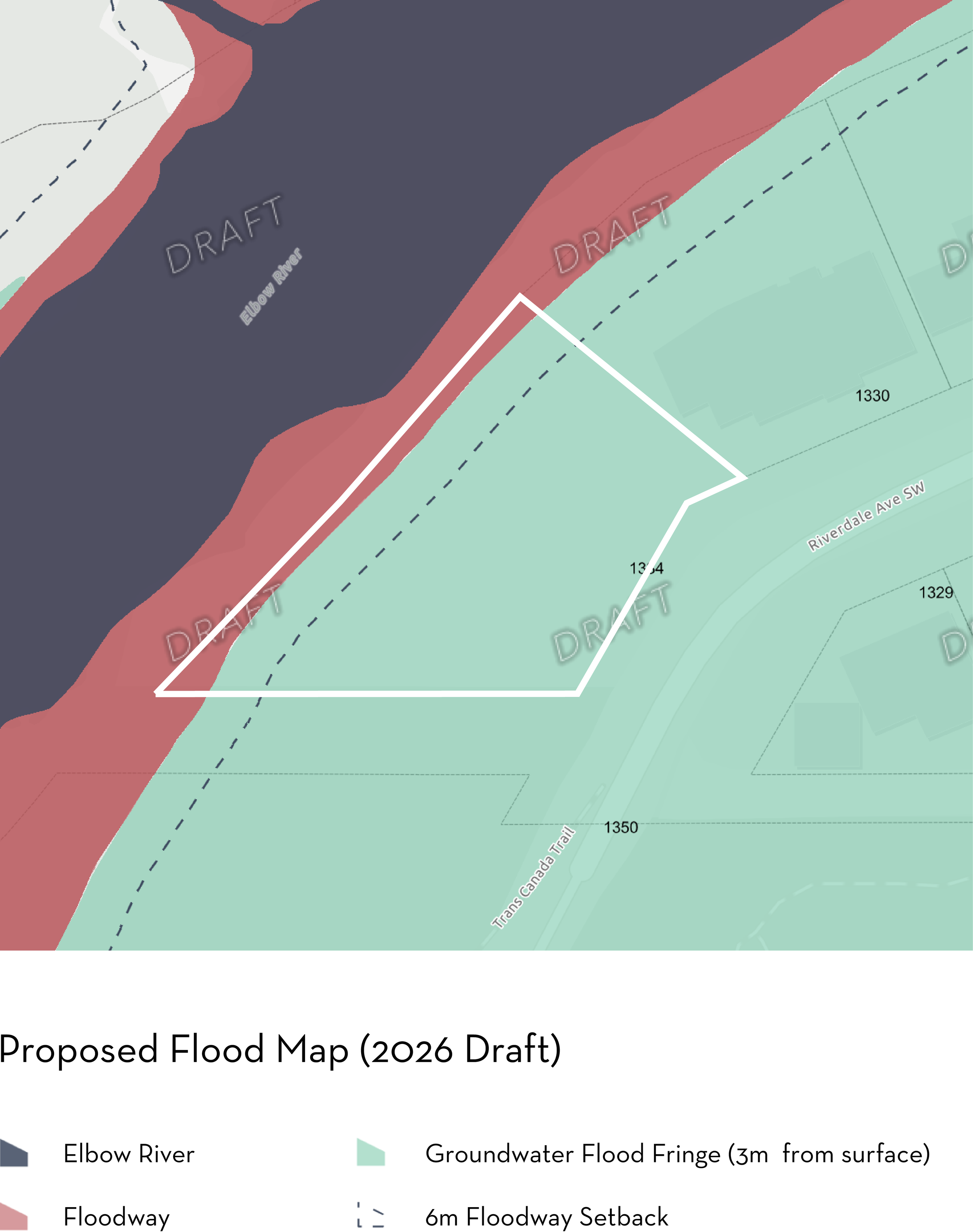
Floodplain mapping in areas such as Elbow Park and Rideau Park is currently being updated to reflect significant upstream flood mitigation investment, including the Government of Alberta's Springbank Off-Stream Reservoir (SR1), alongside updated hydraulic modelling and flood data.
At present, the City of Calgary's Land Use Bylaw 1P2007 still references older flood mapping. However, the Government of Alberta's updated flood mapping identifies portions of this corridor under a less restrictive designation than the City's current bylaw mapping.
The City of Calgary is actively working through amendments to align its flood regulations and mapping with the Province's updated data. According to correspondence with the City's Planning and Development Services department, these amendments are currently underway and are slated to proceed through Council review in 2026.
The proposed updates include transitioning these sites from their current Floodway designation toward a Groundwater Flood Fringe designation under the updated mapping framework. While the bylaw update process is still ongoing, the City has indicated that the anticipated changes are not expected to materially impact general site programming beyond current development requirements.
Until formal adoption occurs, development applications continue to be reviewed under the current Land Use Bylaw. As with any river-adjacent property in Calgary, buyers are encouraged to complete their own due diligence and consult with qualified professionals regarding site-specific development conditions.
For current City of Calgary flood mapping, visit:
https://maps.calgary.ca/RiverFlooding/
For the Province's updated flood mapping, visit:
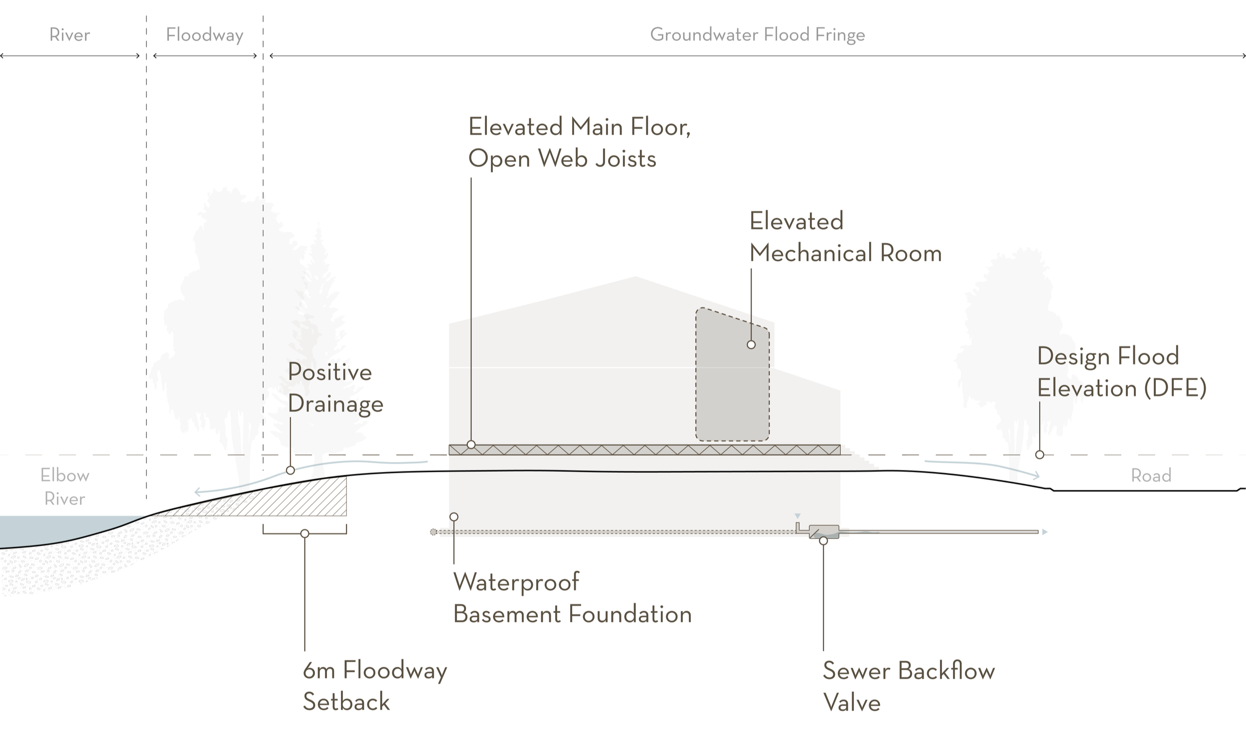
Flood Design Measures (Flood Fringe)
Buildings within the Flood Fringe are required to incorporate the following measures under City of Calgary Land Use Bylaw 1P2007, Part 3 Division 3:
Main floor elevation at or above the designated flood level
Foundations designed to resist hydrostatic pressure
Electrical and mechanical systems elevated above the flood level
Sewer back-up valves and appropriate drainage
Compliance with applicable floodway setbacks